What Is Site Plan Rendering?

SITE PLAN DRAWING
RENDER
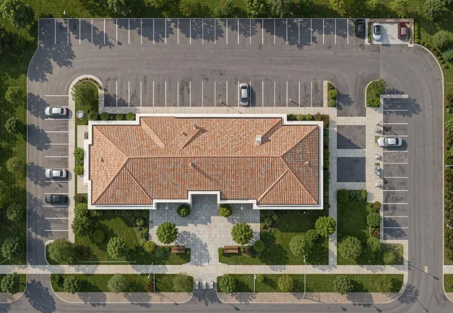
A site plan rendering is the presentation image of a site plan — the technical drawing colored, shadowed and made legible for people who do not read line drawings. The distinction matters in both directions: a site plan is a scaled technical document used for permits and coordination; its rendering is a communication image, and it is one of the six types of architectural rendering.
Producing that image is a four-step workflow.
Site Plan and Masterplan Rendering
Site plan rendering is the process of turning a technical site plan into a colored, readable presentation image; masterplan rendering does the same at district scale. Urban planners, developers and architects use both to carry approvals, investors and community boards. ArchiGPT renders site plans with AI in seconds, in the upload box at the top of this page.
No learning curve
No GPU needed
Ultra fast and accurate
How Do You Render a Site Plan with AI?
A site plan is rendered with AI in 4 steps: upload, describe, select, generate.

Upload the CAD site plan, PDF export or hand sketch as JPG or PNG — up to 4 images per generation.

Describe the treatment — colored plan, landscape palette, shadows — in the prompt box.

Generate the rendered plan with realistic colors or in other style you want.
Edit, refine, download the site plan and get ready to presentation.
Which Inputs Can Be Used for Masterplan Rendering?
Whatever the input, the output is judged by one checklist. The inputs that can be used for masterplan rendering are listed below.

CAD export in JPG/PNG format
The standard input — the drawing renders as drawn.

Zoning or block layout
Early diagrams become presentation images.

Hand-drawn masterplan sketch
Concept line work renders directly.

Aerial photo with a proposed overlay
The plan rendered in its real context.
What Should a Site Plan Rendering Show?
The elements a site plan rendering should show are listed below.
Building footprints and massing.
Circulation: roads, paths and parking.
Landscape and open space.
Water, hills, and terrain.
Shadows and orientation.
Labels and scale kept legible — a rendering that loses its labels loses its audience.
The checklist costs the same whether it is drawn by hand or generated.


Which Site Plan Inputs Can Be Rendered?
Besides floor plans, ArchiGPT renders sketches, photos, and 3D models.

Who Uses Masterplan Rendering?
Urban planners
Community engagement boards that non-professionals can read.
Landscape architects
Open-space systems presented at plan scale.
Architects
Competition boards where the site plan sells the concept.
Civil engineers
Pre-leasing material from the site plan they already have.
How Much Does Site Plan Rendering Cost?
A site plan rendering costs $150–$500+ per plan outsourced with a 24–72 hour turnaround, and $2–$10 per image with AI in seconds.
/
Basic
Perfect for personal and casual use cases.
$19
/month
billed monthly
100 images
Commercial use
Variation
Render history
Upscale
Pro
Most popular
Designed for creators ready to level up.
$39
/month
billed monthly
250 images
Commercial use
Variation
Render history
Upscale
Premium
Ideal for professionals and power users.
$79
/month
billed monthly
500 images
Commercial use
Variation
Render history
Upscale
Ultra
Built for teams, studios, and high-volume creators
$149
/month
billed monthly
1000 images
Commercial use
Variation
Render history
Upscale
Basic
Perfect for personal and casual use cases.
$10
/month
billed yearly $120
6 months free
100 images
Commercial use
Variation
Render history
Upscale
Pro
Most popular
Designed for creators ready to level up.
$20
/month
billed yearly $240
6 months free
250 images
Commercial use
Variation
Render history
Upscale
Premium
Ideal for professionals and power users.
$40
/month
billed yearly $480
6 months free
500 images
Commercial use
Variation
Render history
Upscale
Ultra
Built for teams, studios, and high-volume creators
$75
/month
billed yearly $900
6 months free
1000 images
Commercial use
Variation
Render history
Upscale
One time payment
One-time
$49
/month
billed one time - NO subscription
250 images
Commercial use
Variation
Render history
Upscale
Expires in 30 days
Is a Rendered Site Plan Valid for a Permit?
No — a rendered site plan is a presentation image; permit submissions require a scaled technical site plan prepared from a survey by a surveyor or civil engineer. The working order is the reverse: get the technical plan approved, then render it for marketing, community boards and investors.
Inside that boundary, four groups render plans weekly.
What Is a Colored Site Plan?
A colored site plan is a top-down plan with material and landscape colors, shadows and labels kept legible — the standard board format for approvals and marketing. In Photoshop the coloring takes hours per plan; from an uploaded CAD plan it generates in seconds.
Can AI Create a 3D Site Plan Rendering?
Yes — a flat site plan generates an aerial perspective view with massing, landscape and shadows. One honesty note: the 3D view is interpreted from the 2D plan, so exact building heights come from the prompt, not from the drawing.
At district scale the same workflow renders a different document.
What Is a Masterplan in Architecture?
A masterplan in architecture organizes a district or campus — its blocks, streets, open space and phasing — and its rendering communicates that vision to stakeholders and the public. AI fits the early studies: layout options render in seconds while the urban design is still moving.
Both scales accept the same inputs.
Is there a site plan drawing app?
Rendering runs in the browser; the technical drawing itself stays in CAD — the two are different documents.
How is this different from rendering a site plan in Photoshop?
The output format is the same colored plan; the difference is seconds against hours per iteration.
Can AI help with urban design?
Yes — early massing and layout studies render in seconds; engineering and code compliance stay professional steps.
What is the difference between a masterplan and a site plan?
A site plan documents one site; a masterplan organizes a district or campus of many sites.
Can rendered plans be used commercially?
Yes — all plans include commercial usage rights.